-->

Featured Post

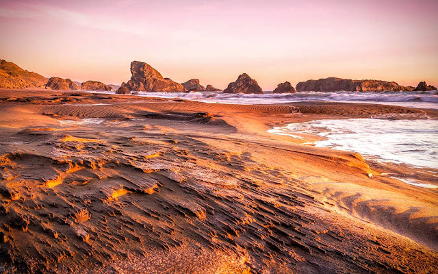
Shi Shi Beach - Olympic Peninsula, WA

After dropping our parents to Sea-Tac airport, we decided to spent couple days in Olympic National Park.  Our plan was to spend a night...

Tatoosh Ridge Hike

Trail Stats - 11 miles RT, 4000 feet elevation gain (cummulative)


On a hot day, some of my friends and two of decided to go explore the Tatoosh Ridge. It was first time for all of us, so we didn't know what to expect. From the trip reports, we knew the start of the trail is going to be extremely steep - gaining about 3000 feet in first 3 miles. We counted the switchbacks going uphill - I think there are about 15 switchbacks. Once up on the ridge, the views start to open up. Soon we came to the junction with Tatoosh Lakes. We decided to push for the summit first. After this junction, Mount Rainer starts to rise above the horizon behind you and the views start to open up in all direction.


After the switchbacks, the trail traverses steep side slope instead of following the ridge line to the summit. This portion last for couple of miles and it is fairly level. After traversing couple of hills, we came to the summit trail junction. Post this trail junction, the trail gets steep again, climbing about 1000 feet in a mile or so. Once at the summit, the views towards Mt Rainer is stupendously gorgeous.

The summit view

Wallowa Mountains adventure - Eagle Cap Wilderness

We wanted to see the Perseid meteor shower. So instead of driving to some dark place and likely getting surrounded by ton of people, we decided to go backpacking.

We started from Two pan trailhead and hike in 7 miles on East Fork Lostine River trail to get to Mirror lake. After setting up the camp, we went up to summit the Eagle Cap mountain (9572 feet). The views from the summit trail kept getting better and better. Once we got to the summit, we could see the entire Lostine River Valley, Hurrican creek drainage, Glacier Lake and of course the entire lake basin area.


On the day 2, after shooting sunrise, we made our way up tp Glacier Lake. It was just 3.5 miles to the Glacier Pass, but that's a steep trail. It took us about 2 hours to get over the pass and to the lake.


On Day 3, we came out the same way we went in. Overall, it was a pretty warm weekend. Somewhat buggy, but not too bad to take all the fun away. Our total mileage was 27 miles with 6800 feet of elevation gain.

Jefferson Park - Epic Wild Flower Show

This is the first year that the US Forest Service started permitting the overnight use of this area. In the years prior to that I have been here - It was always a competition to get the "allowed" campsite and people coming in late would just camp right on the lakeshores or in the meadows. This year, surprisingly it was quite. We got checked in the evening by the ranger and I also saw ranger asking few campers to leave the park can camp outside the boundary. But none the less - it was good to see the area regulated and enforced.

Now get back to the trip report - 
Since this trail never gets super steep at any point, I asked a friend to join in for his first backpacking trip. We started hiking around 11 AM and to my surprise, got to the camp site at 1:30. From the earlier trip reports, we expecting lots of mosquitoes, but since it was a little breezy, bugs never got worse. After setting up the tent and doing a few camp chores, I decided to take a hike up to the Park Ridge. Probably one of the best view of Mount Jefferson. I met few PCT hikers on my way down form the park ridge. Next morning we quickly packed in everything and walked out.

Overall, a very nice and relaxing trip. 

View from half way up to the Park Ridge 
Close-up of the summit
First light on Mt Jefferson
Park meadows from somewhere between Scout Lake and Russell Lake
Sunrise from Russell Lake
After sunset from Scout Lake
Aesha enjoying the warm sunlight at Scout Lake
Russell Lake from above

Road Tripping Oregon Coast

Day 1: Drive from Home to Harris Beach State Park, Brookings

We wanted to get the boring part of the trip of driving on the Interstate out of the way first. So we set out from Home on Thursday afternoon to complete this 7 hrs journey. By the time we got to Brookings, we were really tired. We quickly moved stuff out of the trunk and made space for us to sleep in the car.


Day 2: Brookings to Humbug Mountain State Park, Port Oxford
We woke up around 7 and the weather was perfectly clear and calm. After taking a nice hot shower, we walked to the beach from the campsite only to find out there is a very dense fog hanging right over the coast.
Hanging out at the beach after breakfast
After a nice long breakfast by the beach, we started out day hike to Cape Ferrelo. It was extremely windy and we couldn't even stand still for a second.


Since it was extremely windy, we abandoned our hiking plans as drove to the next viewpoints in Samuel H. Boardman State Scenic Corridor namely House Rock, Natural Bridges and Arch Rock view points and took a little hike at Indian Sands.


Hiking to Indian Sanddunes
For sunset we stopped at Pistol River viewpoint beach. Sunset wasn't particularly spectacular, but we enjoyed it.
Pistol River Sunset

Day 2: Humbug Mountain State Park to Bullard Beach State Park

Another very foggy and windy day till almost the afternoon!

Highlight of the day was definitely watching the sunset at Bandon Beach by Facerock viewpoint.


Day 3: Bandon to Carl G. Washburne State Park

After packing up in the morning, we went to Eel Creek Campground, which is part of Oregon Dunes National Recreation Area and hiked John Dellenbeck Dunes trail. This was a completely different experience compared to what we had seen for 2 days on the coast. Sand Dunes EVERYWHERE! I think the trail is about 3 miles from the parking lot to the beach. It goes through a vast open area with nothing but the sand dunes. We didn't go as far as the beach but made our way to a tree island and had lots of fun going  up and down the sand dunes.


Since we had no camping reservation for the night, we stopped at every single campsite on the way. That took a lot of time. By the afternoon, we got to Cape Perpetua, and found a really nice campsite at Carl G Washburne State Park. After a nice break, we drove down to Heceta Head Lighthouse. Park staff was nice enough to offer the lighthouse tour. Interesting little talk for about 15 mins and they walk you inside the lighthouse.

Heceta Head Lighthouse
After spending some time at the light house, we went to Cape Perpetua and walked around some more trail - eventually making our way down to Devil's Churn. It wasn't churning really high, but we knew that the tide was going to get higher, so we just just sat there by the rocks and enjoyed the waves trashing against the cliffs and splashing higher and higher. Close to sunset, we made our way back to Thor's Well. As expected there were ton of tourist by the tide pool area. Lot of them didn't have much idea about how high the waves can get and how dangerous it is to get too close to the tidepools at high tide. Shooting sunset, I got soaking wet by the crashing waves. But it was an amazing experience.
Thors Well Sunset 
Our House on Wheels
Day 4: Cape Perpetua to Home
By this time we were fairly tired of the coast and seeing the same scenery over and over again. Also we didn't have any reservation for the night. After driving around at stopping at couple of viewpoints around Newport and Lincoln City, we went for a short hike to Thumb Point. From there, we went to Pacific City. By this time, I think we had decided that we are going back home rather than spending a night in Tillamook State Forest - 40 miles away from home. I hve been to Pacific City more than a dozen times, but have never climbed the 500 ft sand dune. It was indeed fun to go up the sand and coming down was even awesome! After having nice dinner at Pelican Pub, we drove around the beach and watched people light up the fireworks.

I had done this same trip couple of years ago, and at that time, we tired and exhausted by the time we got to the southern Oregon Coast. So This time I decided to start from south. In conclusion, I wouldn't start from South again. Main reason being, it you are driving North, you are driving on the inside lane - away from the sea and all the pullouts are on the other side of the road.

Shi Shi Beach - Olympic Peninsula, WA

After dropping our parents to Sea-Tac airport, we decided to spent couple days in Olympic National Park. 

Our plan was to spend a night at Shi-shi Beach and then explore the park's rainforest on the next day. As planned we took the ferry from Seattle downtown and reached Bainbridge Island around 1 PM. I had anticipated that we'd reach the island a little sooner. 

From there we made our way back to the ranger station in Port Angels. We talked to a ranger, got our permits for the night to camp on the beach. The ranger also informed us not to park at the trailhead for the night. He told us to park 1/2 mile before the trailhead at someone's front yard to avoid having the car broken into. He told us that there will be a sign and a dropbox for us to put in $20 as a parking fee and laughed it off by saying that's the bribe. At the time, I didn't quite understand what he was saying. 

From Port Angeles, to Neah Bay is quite a long drive and slow drive with all the twisty road along the coast. We stopped at The Museum at the Makah Culture and Research Center to get our Makah Recreation permit ($10) which is needed to park anywhere in the Makah reservation area. The direction to Shi-shi beach was clearly marked by the signs in the town. We reached the TH at around 6pm. Like the ranger said, it was clearly marked where to park for the overnight use.

After all this, we finally hit the trail. The trail itself was incredibly muddy in lots of places and most of the time unavoidable. After walking through all that for about 2 miles, we got to what looked like a dead end was a beach access trail - it was really steep and rope assisted. We didn't really need to use the ropes, but I can imagine on a wet day, those ropes would be really helpful.

Once on the beach, it was about 2 more miles to Petroleum Creek, where we camped. There were a few people already camping on the beach. I setup our camp and Aesha cooked dinner in the meanwhile. After dinner, she went directly to bed and I hung around enjoying the beach and warm fire.


All in all this was by far the most expensive camping I have ever done. It cost me $40 in total for permits plus parking. I've wanted to do stay here for quite some time, and now that is out of the way, I am probably not going to come all this way - not because it wasn't beautiful, but just because $40 was too much to spend for a camping night!

North Lake via Wyeth Trail

Total mileage - 13 miles
Elevation Gain - 4500 feet

Looking at the map, it looked like series of switchbacks ascending almost 4000 feet in 4 miles. I knew I was in for a good workout.

First miles or so wasn't too bad. The weather was nice and cool with a bit of mist in the air. In no time we climbed 2500 feet and it started to feel like the trail wasn't as hard as I had anticipated. We took a nice long snack break at a viewpoint (Note - There aren't many viewpoints on this trail).

Next half of the trail up to the junction with Green Point Mountain trail seemed much steeper. Uphill ends about a quarter mile before the junction as we reach the ridge. After the junction the trail drops a bit across the scree field with an excellent view of Mount Defiance before climbing couple of hundred feet to the lake. This last 1.5 miles after the junction had some packed snow and with lot of downed trees it was somewhat challenging to stay on the trail, but we followed the creek upstream to get to the lake.


Ramona Falls - Mount Hood

Total Hiking Miles - 8 miles
Elevation Gain - 1200 feet

With very high chance of rain, we wanted to get a short hike in. I hadn't been to Ramona Falls for quite sometime. So we decided to make a trip down there.

It is a fairly flat trail, but the river crossing is tricky. In about a mile form the trailhead, we got to the Sandy River crossing. The bridge was out since it got washed away last year and the Forest Service decided to not put one up for this year. After roaming around, we found a nice log to cross the river on.

After crossing, following relatively flat trail, we got to the falls in an hour or so.


It was nice and quite, only a few people rather than hordes of them on a typical summer day. We made our way back via creekside trail to complete the loop.


Devil's Peak Lookout Overnight

After spending the previous weekend at home, we decided it is time to take advantage of the good weather break. With recent snowfall on Thursday/ Friday, I was worried that we may encounter more snow than what the previous weeks' trip reports suggested. So was the case. Snowline was around 4000 feet and around 4200 feet, we started loosing the trail as we were trying follow few intermittent footprints. Regaining the trail through brush and slushy snow wasn't fun. I think that last mile or so took us about hour and a half to tackle. 
We got to the lookout tower at around 2 PM, happy to see that nobody was there - so we could get the lookout tower to ourselves. After exploring the cabin, we had a little snack and started playing cards.
Right around sunset, wind started picking up. It was howling at around 15-20 mph pretty much throughout the night. Shutter kept flapping around and that kept us up through the night. We woke up just before the sunrise and watched the sun come up behind Mt Hood from the patio. Very soon we were all packed up and hit the trail back to our car. Most of the snow had melted so way back to the car was much more relaxed. 
View of Mt Hood from the lookout tower at sunset

White River Canyon - Mt. Hood Snowshoe

We came very early to White River SnoPark. There weren't many people at the parking lot considering the temperature was about 5 degrees Fahrenheit with light wind. Snow was in perfect condition to snowshoe. 

Quickly we geared up and headed up on the trail. It was perfectly sunny with clear blue sky. We came across few groups of people on the trail. Going up the hill to Boy Scout Ridge was a daunting effort especially because of new snow and we had to cut in steps in. We were sinking in knee deep. After lot of huffing and puffing we made it to the top of the hill. After taking a reasonably long snack break, we made our way back to the car.


By the time we were coming back to the car, lot of people have made a path for us to follow

Expansive view form top of the ridge