-->

Featured Post

Shi Shi Beach - Olympic Peninsula, WA

After dropping our parents to Sea-Tac airport, we decided to spent couple days in Olympic National Park.  Our plan was to spend a night...

Mount Saint Helens Winter Climb

There is a bit of a story here. My group originally decided to climb Mount Saint Helens on Nov 2, 2014. Weather was looking good with clear sky and 25-30mph of summit wind for morning. We thought it would be fine and we will see and make decision as we get higher. That was the forecast! What we encountered was completely different. Constant rain on the lower elevation, higher wind. As we moved higher, rain turned into snow and wind got stronger and it seemed like reaching +50mph. The group still kept going, but eventually after ~7500feet, with less than 50feet of visibility and sideways snow and sleet, we decided to turn back. 

Anyway, that was a good learning. We all had a good time even though we were moving through wintery mix. Good group made it all possible. Everybody stayed strong and upbeat!

By Tuesday, after looking at the weather for next weekend, everyone came to a conclusion that it is time to finish what we started. So, here we go! November 8, 2014, we meet again at 5AM at a meeting place in Portland. Everyone excited to summit Mt Saint Helens. 

We started hiking at 8AM from climber's bivouac towards Monitor Ridge. I have been on the summit once before and counting the attempt on the week before this was my 3rd time. It seemed much easier than the first time. First thing that we noticed was the snow level has retreated quite a bit. We did not get into snow up until 7500feet. The weekend before, we were in the snow at 5000feet. Nothing too eventful on the way up or down. We got to the summit by 12 noon and spend around an hour soaking in the sun and the surroundings. 

At the summit of Mount Saint Helens

Crown Point Vistahouse

Vista house under full moon. I added a little bit light paining to this image to add some contrast.


Snow Dragon Ice Cave - Mt Hood

Last year I came across a PBS documentary about ice caves under sandy glacier on Mt Hood, but I wasn't physically fit to join a group for this adventure. Getting to one of these ice cave requires serious route finding and traveling across steep scree slop and rock fields with constant risk of rock falls. I wasn't prepared for it.

This year, I decided to give it a try and joined a group of expieriecd hikers, some of them had been there before. It still requires route finding and deep knowledge of the area. We accesnded up from Top Spur TH and caught Timberline Trail going up to the McNeil Point Shelter. Rather than following the Timberline Trail, we cut across via climbers cutoff (very steep shortcut to the stone shelter!).

Weather was supposed to get better as the day goes on, but it didn't turn up that way. It actually worded as the day progressed. We started with cloud and fog. It soon became very windy with gust about about 40mph. After the stone shelter, we had to an off trail traverse. Visibilty started to deteriorate very rapidly as we moved on to off trail part of our trip. We couldn't see more than 100 feet beyond us. 

Absolutely zero visibility!
Fortunately, PBS is still mapping the caves in the area and they have marked the trail with orange flags marks. We started following those for most of the way. At some point we lost track and ended up way above the cave. Lack of visibility and bad weather, made us worried and we decided to stop for lunch and go back. 

All of a sudden, weather opened up slightly and to our surprise, we were within 300 feet of the cave opening. After finishing our lunch, we headed for the cave.

Snow Dragon Ice Cave
As we were exploring the cave, sever hail storm started. We packed up and hurried back up. We didn't want to get caught up in these conditions. Few minutes later, we heard thunder and lightning. First words that came out of everyone -- "FUCK! Lets get out of here." Rain got heavier and with high winds, it became were difficult off trail travel. We finally made it back to the shelter. Even though the weather was still stormy, it was bit of a relief as we got out of the open exposed area and now going to travel under the canopy of large tree and on a defined trail.

Last 5 miles back to the car went fast. My pant and shoes were completely drenched at this point and changing into a fresh pair felt so much better. 

Jefferson Park Backpacking

I did a 3 day backpacking trip to Jefferson Park from 12-Sep-2014 to 14-Sep-2014.

We started at the Breitenbush TH. 6 miles drive to this trailhead on Skyline road took almost an hour, since the road was in awful condition with giant boulders and potholes. 

First 3 miles are mostly forested. Trail went up gentally as we followed PCT south. After that you enter a sub-alpine area which looks like a moonscape or some extra terrestrial landscape. Trail continues to climb aggressively toward the Park Ridge. As you get to the top, view opens up to the entire Jefferson Park and Mt Jefferson is standing right in front of you. You can see Russell Lake from the Park Ridge. From here it is all downhill as the trail switch backs down to the lakes in the Jefferson Park. First is Russell Lake and then as you follow PCT, Scout Lake and Bays Lake comes next. There are trails all around in this regions with many small lakes in the area. 

Jefferson Park is probably the best place to see Mt Jefferson in all its glory. I tried to capture few moments here. I was hoping for some more clouds to get more drama in the sky, but instead I got perfectly blue sky for all 3 days.  

Mt Jefferson at sunrise from Russell Lake

Mt Jefferson after sunset from Scout Lake

Mt Jefferson at sunset from Scout Lake

South Sister Summit

I decided to climb South Sister in couple of weeks after summiting Mt Saint Helens. I was so impressed by watching sunrise from the summit of Mt Saint Helens that I decide to do the same this time. Since summit route to South Sister is longer and more difficult, I decided with my group to hike in third of the way in the day before and get some rest before the summit push,


We hiked in from Devil's Lake TH for couple of miles to Moraine Lake. Since the lake was few hundred feet below the trail, we decided to find a secluded spot in the wood next to the summit trail. 

At 1 AM, we made a start for the summit. First mile was almost flat and left us wondering to what's going to come ahead. In the dark, we couldn't see much. We only had a faint trail to follow to the summit. We reached teardrop lake, 2000 feet below the summit. Temperature was dropping down and it was getting windier. We had a quick snack break and kept going upwards and onwards. Up till this point, we haven't seen any groups. We started discussing that are we the only crazy souls to do this, that can't be true! After few minutes, we saw few headlamps coming our way and it immediately gave us some sense of relief that we are not the only ones on the mountain.

We reached the summit half and hour before sunrise. Temperature was definitely below freezing. We took shelter in one of the windbreakers at the summit and waited for sunrise. It was cold. I was wearing everything that I carried up with me (Fleece, Down Jacket, Rain Jacket). I was still cold. I also carried my down quilt up to the summit just for the scenario that in case we get there earlier than sunrise, then we'd need something to keep us warm. It came in handy, as we sat in a huddle using the quilt as a comforter. 

Few minutes later, as the sun was coming up, I broke the huddle and walked around the summit ridge to get blood flowing through my body and get some warmth. Soon after, the entire sky was glowing warm orange with a nice glow on the snowfields visible on Middle Sister. I took few shots and enjoyed the summit view before heading down.

Contrary to hike up, we saw tons of people coming up as we were going down. We kept turning around to see our approach as we walked in the dark and had no perspective of how far we have climbed.

Overall, it was about 14 miles and 5800feet of cumulative elevation gain. Totally worth the sunrise view that we got at the top. 


Summit View from South Sister

Eagle Cap Wilderness Backpack

This was a 4 day backpacking trip to Eagle cap Wilderness in Easter Oregon - One of the most scenic and more popular backpacking loop. I planned this trip 3 months in advance and as the day come closure, weather started to take a nasty turn - rain and thunderstorm expected over the coarse of first 3 days. I had doubts in my mind as I packed up for this trip, but in the end my group decided to give it a shot.

Day 0 - Drive from Portland to Wallowa Lake State park Campground
We left Portland at around 4 PM, stopped for dinner in Hood River and reached the campground around 1 AM. I already had made the reservation for a campsite, so we found our spot and went to bed. It rained all night, heavy rain - which means I packed up a wet tent at the start of this hike.

Day 1 - Two Pan Trailhead to Minam Lake
Before starting a hike, we stopped in Joseph for a good breakfast and made a quick stop at ranger station to check for trail condition and fire closure. From Two Pan TH to Minam Lake is about 7 miles, 2000 feet hike. Trail is mostly gentle uphill with few steep areas. We found a campsite very close to the main trail and setup our tents. As soon as we were done setting up our tents, we noticed dark clouds rolling in, weather had changed from sunny to dark thunderstorm clouds in a passage of 30 mins. We enjoyed all the lightning and thunder sitting by our camp. It rained for awhile, so it was time for a nap. Everything cleared up in few hours before dinner. We had a nice fire going by now and enjoyed dinner sitting next to the fire. That was it for the day. It pretty much rained all night.


Day 2 - Minam Lake to Mirror Lake
We woke up to clear blue sky. cooked our breakfast and with thunderstorm predicted around noon, we started making our way to Mirror Lake. Our only worry was that we have to cross a mountain pass at ~8000feet elevation and we didn't want to get stuck in the thunderstorm exposed on the ridge. It was a short steep climb towards the pass, trail gained about 1500 feet in less than 1.5 miles. Once we got to the top, we could see dark clouds looming in the distance. This was our first view of the Eagle Cap and Mirror Lake just below that.


Lake Basin area
Camping at Mirror Lake


Day3 - Mirror Lake to Glacier Lake
I woke up early and walked to Sunshine Lake before sunrise to capture morning light on the Eagle Cap peak. It was a calm morning and I got a pretty good reflection in the lake.

Morning Glow on the Eagle Cap at Sunshine Lake 
Sunshine Lake at sunrise
My friends decided to base camp at Mirror Lake, but I wanted to go upto Glacier Lake and stay overnight. It was a steep climb over Glacier Pass for about 2000 feet. I got a very nice camp spot by the lake. There was one other group by camping by the lake. 

Day 4 - Glacier Lake to Two Pan TH
I woke up 30 mins before sunrise and hiked around the lake to capture alpenglow on Glacier Peak and Eagle Cap. After doing some morning photography and breakfast, I hiked down to the Mirror Lake and waited for my friends to get ready. Hike out had very specular views through out as we followed another fork of Lostine River. Last couple of miles were very steep decent, which made us all tired. Last day was about 12 miles for me.

Camp Spot at Glacier Lake
Alpenglow over Glacier Peak (left) and Eagle Cap (right)

Mt Saint Helens Summit

I started the climb with 5 other friends of mine. It was a peak summer time, so to save us from extreme heat and sun, we decided to approach this climb at night. We gathered at the trailhead at midnight, prepared our gear and started slowly.

First mile or so, it is nice and easy forest walk. Before you get out the forest, there is a restroom. We stashed 1 liter of water per person behind a tree here for the hike back, just in case we were out of water completely. Everything was fine until now.

After this, next section is boulder fields. one after another. Trail is very well marked with wooden poles, even at night you can see them easily. we had no trouble finding them. We kept a tight group until this point, since we didn't want to loose anyone in the dark. One guy in my group was really slow and not feeling well. He tried to continue up, but at some point he fell behind and got separated from the group. He then decided to go back down. We on the other hand kept shouting his name and waited 30 mins for him. No signs! Worried , but having known that he had done this before we convinced ourselves that he'd be fine.

There was another group that passed us very early on in the forest area, from the same group two girls were left behind, they decided to join us for the company. We share fun moments to the summit.

After we crossed our last boulder field, ~1200 feet below the summit,we came across this huge scree slope. It looked terrifying. Eveyone was in great shape until this, but last mile and 1200 feet of scree field, proved much more difficult than it seemed earlier. Two step forward and one step back! I kept looking at my GPS and to the ridge line standing in front of me, thinking this is it… few more steps and I will be at the top! But, for quite awhile, summit did not seem to get any closer. 

It was getting brighter as it was getting closer to sunrise. I was carrying my camera and tripod and hoping for a great sunrise. I wanted to catch the first light. 100 feet below the summit, I got a huge adrenaline rush as I saw the sun was about to come up. I ran up the slope, didn't care how my legs felt during that time, setup my camera just in time to catch this amazing sunrise!


You can see the crater and steam coming out of it on the lower left of the photo. In the diastase, Spirit Lake (formed by the volcanic eruption) is visible with reflection of the clouds. 

After soaking up the views, it was time to go back. We all thought going down would be much easier! Sure -- 1st mile was piece of cake, as we ran down the scree slope in 30 mins. It took us well over an hour to get up this slope. After that, getting through the boulder field was very painful. My knees were completely dead by the time I got to the forest. Every single person that we came across during our decent, asked about friend that we lost in the beginning and said he is waiting at the trailhead. 

Overall, it was 9 miles and 4600 feet elevation gain. Great experience, but I felt exhausted after this. We stopped for celebratory beer after the hike and re-lived our moments. 

Sparks Lake

Sparks Lake is located about 25 miles west of Bend off the Cascade Lakes Highway. View is mostly dominated by South Sister (10,358 feet), Broken Top (9,175 feet) and Mount Bachelor (9,065 feet).

This is my first time visiting this place. After seeing spectacular sunrise from here, I can see why landscape photographers flock this place. There weren't many clouds in the sky, but it was a calm morning. I was able to get some amazing reflection on the lake.

Sunrise from Sparks Lake (South Sister and Broken Top from left to right)


Ramona Falls


This is one of easiest/ moderate and classic hikes in Mt Hood region near Portland. On a good sunny weekend in summer, there may be 100 cars parked at the trailhead. If you want solitude, go early. Get to the trailhead at 7 AM. 

Anyway, there is already enough said about the trail on internet and I did this hike again only to photograph the waterfalls. I was the first one to get to the waterfall that Sunday and I enjoyed moving around in this area without having to worry about other hikers.

Overall trip milage was 7 miles and 1000 feet elevation gain., but the trail is very very gentle and you don't even feel like there is any elevation gain.

Ramona Falls

Tillamook Head - Oregon Coast Hike

We began by setting up a car shuttle from Tillamook Head trailhead (startpoint) to Ecola State Park (endpoint). This was going to be fairly moderate hike with great views out to the pacific ocean as we pass through Tillamook head lighthouse and Indian beach on towards Ecola state park.

Trail gained elevation aggressively in the beginning as it climbed about 1200feet above sea level. After that it rolled gently through thick forest. Since it had rained the day before, trail was very muddy and slippery at times, but the spring green color popped greatly in wet forest.

Here are some forest shots.


After we were done hiking, We went to Cannon beach, grabbed cold pint and enjoyed pizza at a local restaurant. Then it was time to go back to the park and watch sunset. I had this shot in my mind for a while, but I never got around to come here and spend time. This is a classic Oregon coast image with the famous Haystack Rock in the distance 

Classic Oregon Coast View


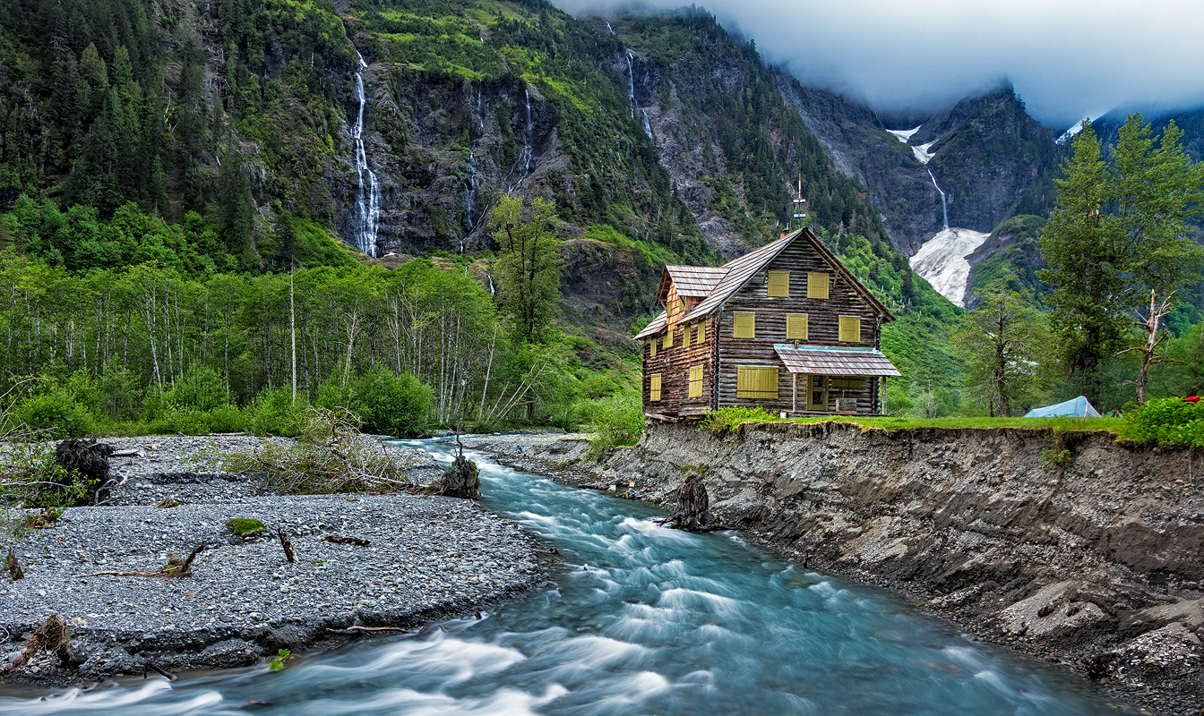
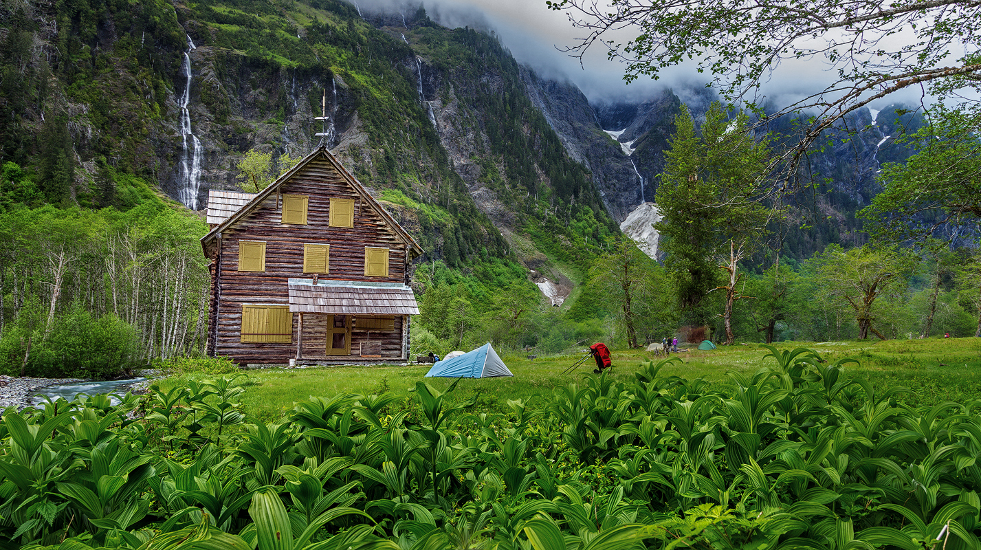
Enchanted Valley Chalet

It was a labor day weekend. We expected a sea of people to on this trail. To avoid the crowd, we decided to backpack in on Friday. I think that was a right decision. We did not run into lot of people. The plan was to hike in 7 miles to O'Neil camp for the first night, finish the last 5 miles to the chalet and camp near the chalet.

We followed the plan for the most part, few people in the group decided to base camp at 7 miles and day hike to the shelter to avoid hiking out 13 miles together on the last day.

We got to the chalet on Saturday around noon. There weren't many people. By the nightfall, this place was full of campers. I must have seen at least 200 hikers. It was a BUSY place.

Enchanted Valley Chalet after sunset

Enchanted Valley Chalet after sunset